Volunteers find, map
101 cemeteries and counting!
By Peggy Aulisio
Courtesy of
Westport Shorelines
January 17,
2008
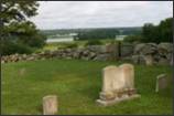
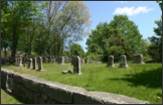
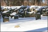
 It has taken two years, but volunteers have mapped out all
of the known cemeteries in town, including old family plots and unmarked fieldstones
deep in the woods. The total count right now is 101, but Paul Pannoni said, "There may be a few more out there
somewhere."
It has taken two years, but volunteers have mapped out all
of the known cemeteries in town, including old family plots and unmarked fieldstones
deep in the woods. The total count right now is 101, but Paul Pannoni said, "There may be a few more out there
somewhere."
The impetus
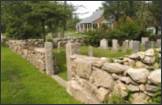
for their effort was the day developer ELJ, Inc., of
Bristol, R.I., created a huge public outcry by removing 20 unmarked fieldstones
from the woods off Charlotte White Road. Quakers did not mark headstones prior
to 1850. Many farmers and Indians also did not mark headstones back then.
ELJ's
owners suggested it was a horse cemetery, but a special probing device used by
Public Archaelogy Laboratory found human remains.
Betty Slade, who started the cemetery identification group, said PAL thought
the remains may have belonged to the Howard family.
The upshot
of a settlement arranged with the district attorney was that ELJ had to return the stones and maintain the cemetery. To
many, the developer, who never appeared in court, was barely given a slap on
the wrist.
"My
feeling was that the town lost the case because the cemetery wasn't
registered," said Ms. Slade. "The town couldn't prove it was a
cemetery so I decided, let's register them."
Ms. Slade
said it was confirmed later that the lack of an official registration for the
old cemetery was a "big part of the case."
Ms. Slade
called for volunteers on the cable access scroll and local media. About 15
volunteers showed up including Andrew Isidoro, a high
school student, who worked on the project from beginning to the end.
The group
consulted with Judith Lund who wrote a book about the cemeteries in Dartmouth.
"She said, 'Don't do a book, do a digital
study,'" Ms. Slade said.
Her
recommendation was apt and showed foresight. Not long ago, a developer removed
stones from an old cemetery in Dartmouth.
Although
Ms. Lund had researched the cemetery for her book, the town didn't have the
locations marked on any database or geographic information system (GIS). Now
Dartmouth town officials are working to rectify that situation, Ms. Slade said.
Westport's
cemetery identification group had to learn how to use modern tools in its
research.
"It
was new tools like digital GPS," Mr. Pannoni
said. "I had never done that before."
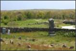
But he
learned. Deep in the woods one day, he used his GPS to mark the locations of
fieldstones that were clearly laid out in rows. There was no path leading to
the plot; the area was filled with overgrown brush and briars.
The main
source in the beginning was the research done by the late Eleanor Tripp, which
is kept in a binder at the library. Mrs. Tripp used a book called Westport
Vital Records, which lists burial records beginning in 1850. She registered 65
cemeteries with the Massachusetts Historical Commission in April 1979.
Mrs. Tripp
used a typewriter to compile her list. Unfortunately, her descriptions were not
precise enough to prove that a cemetery she mentioned existed right where ELJ removed fieldstones.
"It
was the dark ages for computers," Mr. Pannoni
said. "Everything we collected went right on the computer. There was no
such thing as sticking it in a yellow folder and forgetting about it."
After
getting the word out about their project, the group learned about 36 more
cemeteries, for a total of 101. They also have compiled records of 1,250 people
who were buried in non-public cemeteries, including whether someone served in
the military. The town has no official records of these people, Ms. Slade said.
The group
would like to compile a database on people buried in the town's cemeteries,
too, because right now, the cemetery department uses 3 x 5 cards, Ms. Slade
said. "The hope is the town will do a survey on the public cemeteries and
provide software to the cemetery department."
The
information the volunteers have recorded is on computer spreadsheets and on Google
maps. The goal is for town to put it into its GIS systems in the planning
department and assessors' office.
The
cemetery identification group is also working on a website, which another
volunteer, Garry Harstad, is developing. That way,
anyone can easily access the information.
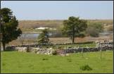
About 61
percent of Westport's cemeteries are out of the public view. They are not close
to a road and are difficult to find, even if someone has the address.
That makes
it even more important to make sure the cemetery sites are identified on a GIS
map in all town offices that deal with developers and builders.
"You gotta be able when a developer comes from out of town and
goes into the assessors' office, when they see a red flag on a map or a
computer to ask questions," Mr. Pannoni said.
Asked who
they identified as the oldest known resident buried here, Ms. Slade said they
heard from Richard Gifford of Little Compton, an expert on Quaker cemeteries,
that he thought one of his ancestors, Jeremiah Devoll,
was buried in what is now referred to as the ELJ
cemetery. He died in 1712.
- - - - - - End - - - - - -
Community Events of Westport © 2008
All rights reserved.