Westport
in Brief!
EverythingWestport.com
Thursday,
August 08, 2013
photos/EverythingWestport.com except as noted
Quick
Article Index . . .
Scientists Search for Non-Native Species That Pose Threats
to Commonwealth’s Marine Environment.
|
Selectmen’s
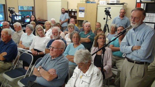
meeting on Monday, August 5th was packed with harbor residents. EverythingWestport.com Thursday,
August 08, 2013 Photos/EverythingWestport.com except as noted
But controversy
still swirls around the town’s plan to open the embattled town road that has
been the victim of damaging coastal storms and irate neighbors who are less
than thrilled about the road’s opening to public vehicular traffic. Inset: Finance Committee and CPC member Warren Messier speaks at this week’s
selectmen’s meeting, crowded with Harbor residents. Messier suggested
something could be done with CPA funds to appraise and possibly purchase a
parcel of beachfront land being offered to the town, but “a project proposal
would need to come before his board.” “Beach Avenue is
a town road, and the public has the right to use it to access the town-owned
beach frontage,” select board vice chairman Richard Spirlet said. Harbor residents
are still concerned about the plan, but are encouraged with the tone of the
Beach Committee’s plan to move forward. “The Beach
Committee seems to be trying to do this responsibly,” Acoaxet resident Burt
Bryan said at the last Selectmen’s meeting. “The Beach
Committee has met twice in the last three weeks,” committee chairman Tim St.
Michel said in a letter to the select board, read by new committee member
Leone Farias. “Beach Ave. has
been with us for over 75 years, and we believe that Beach Ave should (be)
opened in phases: phase 1 would be opened for 725 feet to accommodate 30
vehicles with valid beach passes.” There are now
approximately 13 beach-permitted parking spaces requiring beach passes on the
east side of Acoaxet Street between Atlantic Ave. and the town’s right-of-way
to the Atlantic Ocean. The western
boundary of the town-owned land is 1054 feet from the gated entrance to Beach
Avenue, and is over a quarter mile to the east of Elephant Rock Beach Club. Is Acoaxet an environmentally sensitive
area? The Acoaxet
shoreline extending west from the Nubble to Atlantic Street has been incorrectly
identified by some as a barrier beach. Also, according
to John Berg, Sakonnet landscape manager for The Nature Conservancy (TNC),
“The endangered piping plover has not nested there this year, but has nested
there in previous years. As for other endangered species, the piping plover
is the extent of our work on Acoaxet.” The Rhode Island
Chapter of the Nature Conservancy oversees protection efforts on Acoaxet. Allens Pond Sanctuary Director,
Gina Purtell, said “The piping plover avoids heavily
vegetated ground for nesting,” a habitat predominately found at Acoaxet. Open
ground, such as that found on Cherry & Webb Beach, allows the piping
plover to easily spot predators, of which there are many along the Westport
shoreline. The town already
has Massachusetts Department of Environmental Protection’s (DEP) approval to
keep the road clear of sand and debris from storms. Beach Committee
member Leone Farias said the committee proposes a
“walk-over, prefabricated bridge” to allow visitors to access the town beach,
which would be less intrusive than cutting the native vegetation.” Beach Committee advocates proceeding
cautiously and prudently. “The town should
allow this initial phase to work to everyone’s satisfaction before proceeding
any further. Patience and consideration for all is important so that all
Westport residents can enjoy Beach Ave.,” St. Michel wrote. “Whatever we
decide upon should be reviewed quarterly and annually to assure
environmental, neighborhood and citizen interests are being served as best as
possible,” committee member Jeff Bull told selectmen. “I hope the
differences in legal opinions about road maintenance can be resolved
gracefully so that beach management and neighborhood communication can
proceed effectively,” Bull said. The Beach
Committee recommended the road be opened from 9:00 a.m. to 9 p.m. with
morning roadside trash pickup by a Beach Committee employee or contractor. Closing time in
the winter would be earlier, probably a set time to avoid residents’ confusion
as to the beaches’ closing time said select board vice chairman Richard
Spirlet. Discussion and
negotiation on acquiring the additional 480 feet of beach front for public
access will be put on the back burner while this review process is ongoing, selectmen
said. The Town of
Westport already has 109 feet of beach adjoining the proposed acquisition
(see map below.) Westport acquired its 109-foot lot on June, 19, 1984 from
the Trust Real Estate Department in Boston. Elaine Ostroff, chairwoman of the town’s Commission on
Disability, told Selectmen that this could be “the best beach in town” for
those with disabilities because it is so close to potential parking places, a
real issue at Cherry & Webb Beach where crowded parking, long access
distance and heavy sand pose a challenge for the elderly and disabled to use
the beach. In 2011, Westport
resident Tom Hancock proposed the town acquire use of state-owned land at the
southeastern end of Bridge Road near the Back Eddy Restaurant as a possible
third town beach. Hancock said he sees families and seniors (though very few)
struggling to go up over the dunes to reach Cherry & Webb Beach. That proposal
died when the Massachusetts Department of Conservation and Recreation showed little
interest in letting Westport use that section of coastal barrier beach, a
part of Horseneck Beach, for private town use as
parking would be on protected land. Photos by EverythingWestport.com © 2013 All rights reserved. August 2, 2013
Click on
image to enlarge. Selectmen are considering the expansion of
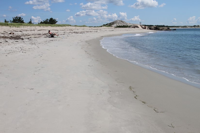
a third town beach on town-owned land off Beach Avenue. Opening the
controversial road to provide access was prompted by a recent offer from
Westport attorney Brian Corey to sell the town a 1.44 acre parcel (map 89,
lot 8) that abuts the town’s lot to the west. The land was
purchased by Black Rock Beach LLC for $150,000 on November 16, 2009 from
Emile Morad, Jr., who purchased the unbuildable
land on June 9, 2004 for $70,000. The
town currently assesses the value of the lot at $43,200. The price is
still under negotiation. If the town
agrees to purchase the land, an expanded third town beach consisting of 589
feet of pristine shoreline would be available to the public. Select board
chairman Antone Vieira has suggested Community
Preservation Act Funds might be available to purchase the Black Rock Beach
land, providing the town could negotiate a fair price. The Westport Land
Conservation Trust has land abutting the town’s lot to the east that
stretches to the government-owned Nubble, adding another 500 feet of
beachfront available to the public for passive recreational use. What’s next? Selectmen have
asked the Beach Committee to return to their next meeting armed with a more
detailed proposal, particularly addressing bathroom facilities, possible life
guards (East Beach currently does not employ life guards), and a turnaround
at the end of Beach Avenue, which would require Conservation Commission
approval. Vieira asked Town
Administrator Jack Healey to work with Beach Committee members to get the
process going on the initial phase of requesting money from CPC to appraise
the Black Rock Beach land. The Beach Committee
is next scheduled to meet on Thursday, August 15th, 7:00 p.m. at Town Hall.
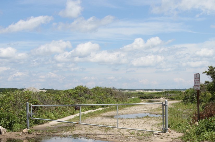
Gated entrance to East Beach
Avenue.
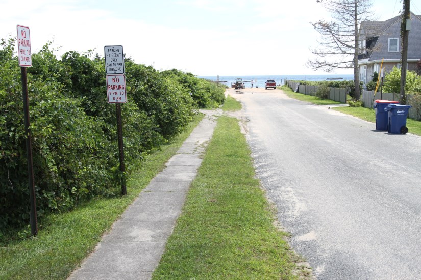
Permitted beach parking on the east side of Acoaxet Street allows for
approximately nine vehicles.
Town landing at the end of
Acoaxet Street allows for three permitted parking spaces. Left: looking east down Beach
Avenue from the gate. Right:
looking east down Beach Avenue at the road’s first bend.
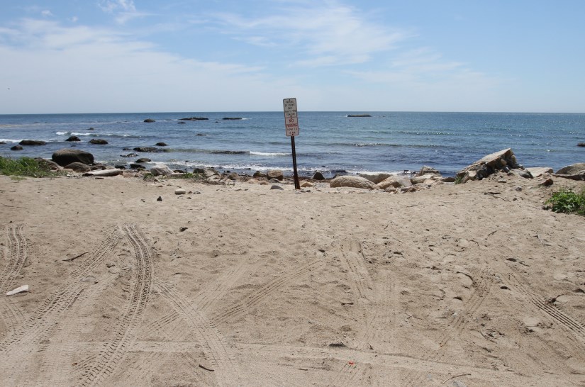
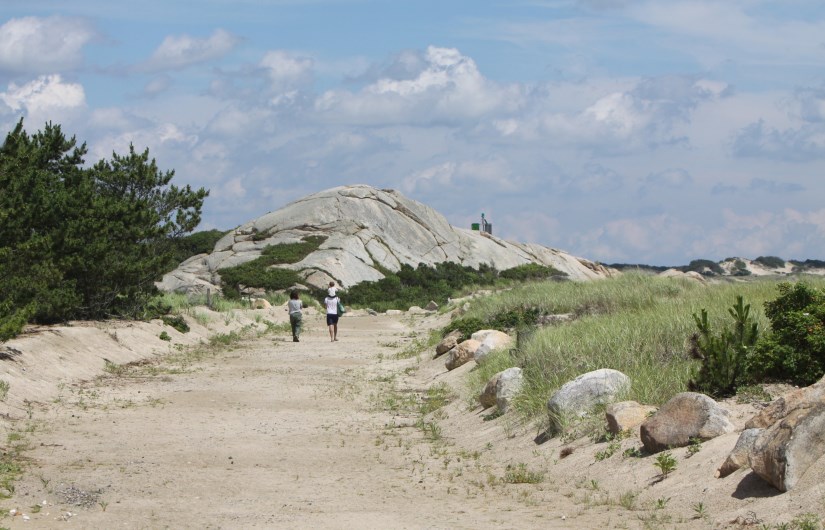
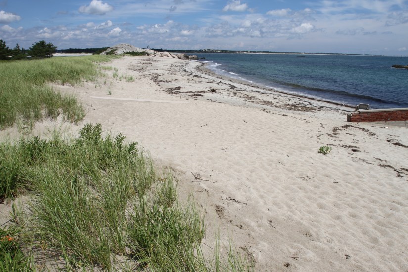
Taking a walk to the Nubble along the far east end of Beach Avenue.
Looking east towards the Nubble
over the town-owned land, a private lot, and Westport Land Conservation Trust
land.
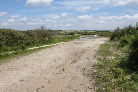
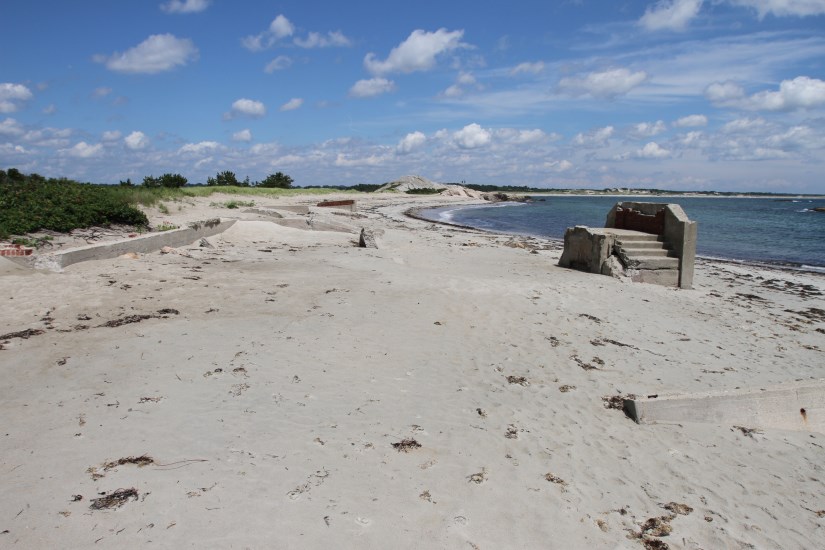
Looking west over the 109
feet of town-owned land and the 480 feet of beachfront land being offered to
the town by the Black Rock Beach LLC represented by Westport attorney Brian
Corey. Concrete remains of seaside cottages destroyed by the hurricane of ’38
can still be seen partially buried in the sand.
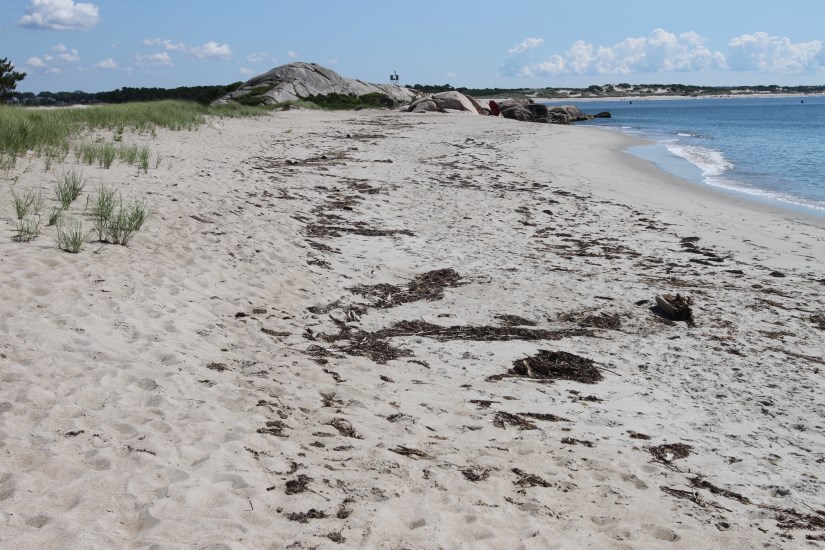
Looking east towards the
Nubble over the town-owned land, a private lot, and Westport Land
Conservation Trust land.
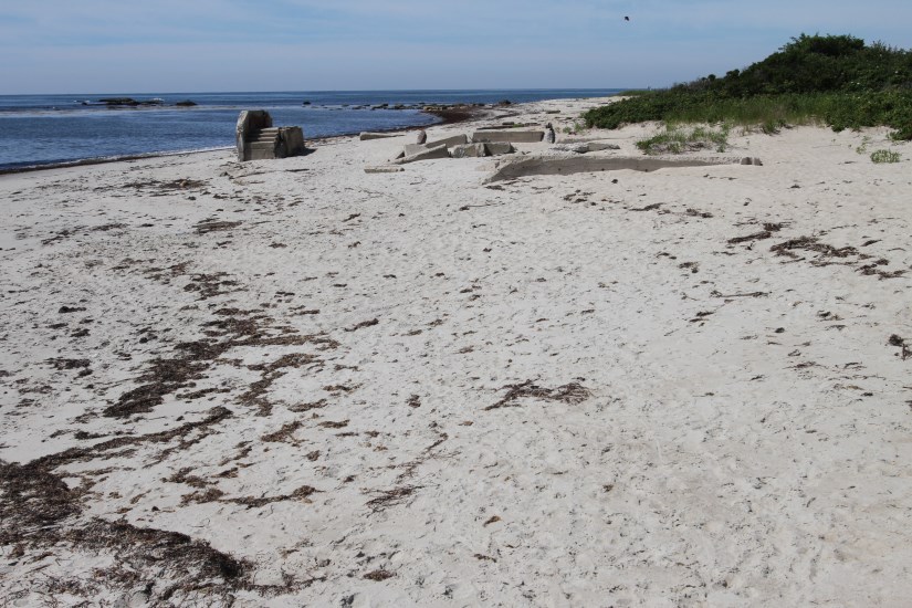
Looking east over the 480
feet of Black Rock Beach LLC land, the 109 feet of town-owned land, and the
Westport Land Conservation Trust land. The concrete remains of seaside
cottages destroyed by the hurricane of ’38 can still be seen partially buried
in the sand on the Black Rock Beach LLC land.
Another easterly view showing
the shoreline’s vegetation. Scientists Search for Non-Native
Species That Pose Threats to Commonwealth’s Marine Environment. F.L. Tripp and Son's boatyard in Westport is one of the
local sites scheduled for visits. EverythingWestport.com Wednesday, August
7, 2013
The inspection of
permanent floating docks and rocky shores in Salem, Boston, Marshfield,
Sandwich, Bourne, Woods Hole, New Bedford and Westport is coordinated by the
Massachusetts Office of Coastal Zone Management (CZM) in the Executive Office
of Energy and Environmental Affairs (EEA) and the Massachusetts Institute of
Technology (MIT) Sea Grant, a research program of the National Oceanic and Atmospheric
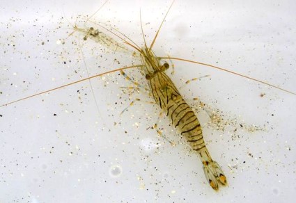
Administration. Inset: The fast-spreading Europeans shrimp (shown here is the pool pawn) is
of particular concern. The four-day
Massachusetts sweep is part of a six-day regional effort to collect, identify
and catalog marine organisms in coastal waters from Maine’s mid-coast to Cape
Cod and Rhode Island. Goals of the study include developing a baseline
inventory of marine species, identifying species recently introduced to local
ecosystems and helping natural resource managers prevent and control future
invasions of non-native species. Surveys in 2000, 2003, 2007 and 2010
revealed over 30 introduced marine organisms, several of which were
identified for the first time in New England coastal waters.
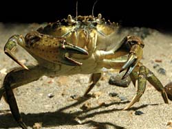
Right: Asian shore crab prey on commercially valiable
shellfish. “Factors such as
global trade and shipping and increasing temperatures associated with climate
change have recently accelerated the spread of new and non-native species
into local waters,” said CZM Director Bruce Carlisle. “This rapid assessment
survey helps us track changes in the marine ecosystem and build the scientific
knowledge needed for the development of effective prevention practices and
control methods. I’d like to thank the researchers for their time and
expertise under this demanding survey schedule.” In New England
coastal waters, the European green crab and Asian shore crab prey on
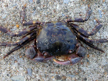
commercially valuable shellfish, while other invasive species Inset: European green crabs are voracious predators of native shellfish and
crustaceans. The following is the research schedule for
the rapid assessment survey: August 5 -
Hawthorne Cove Marina in Salem August 6 - Rowes Wharf in Boston, Green Harbor Marina in Marshfield August 8 -
Sandwich Marina in Sandwich, Massachusetts Maritime Academy in Bourne, Coast
Guard Station in Woods Hole August 9 - Pope’s Island Marina in New
Bedford and F.L. Tripp and Son’s in Westport In addition to
CZM and the MIT Sea Grant, other organizations participating and providing
funds and support for this week’s survey include the Massachusetts Bays
Program, Casco Bay Estuary Partnership, Northeast Aquatic Nuisance Species
Panel, Piscataqua Region Estuaries Partnership,
Narragansett Bay Estuary Program and Rhode Island Bays, Rivers, and
Watersheds Coordination Team. Scientists participating in the project include
two CZM staff as well as researchers hailing from the Netherlands, Brazil and
the United States. © 2013 Community Events of Westport. All rights
reserved. EverythingWestport.com |